Beginning in the center of Zermatt, the Höhbalmen trail climbs through a pleasant forest of larch pine, switchbacking alongside a cascade of snowmelt called the Triftbach. The trail eventually emerges above tree line in a high alpine valley at a place called Trift. There’s no town at Trift, just a softly flowing stream, a few grazing sheep, and a historic guesthouse called the Hotel du Trift offering phenomenal views. If the weather is good, a hiker can order a beverage at the hotel, have a seat at one of the outside tables, and gaze across the Mattertal (the valley that Zermatt sits in) to the Dufourspitze, the highest summit in Switzerland at 15,203 feet/4,534 meters. Trift is a peaceful but rugged place. An avalanche took out the first Hotel du Trift in the late 1800’s, so the owners built a second, identical one in 1900. A hiker could easily end their journey at the Hotel du Trift and return home with wonderful stories, but the Höhbalmen trail doesn’t end at Trift. The journey is only just beginning.
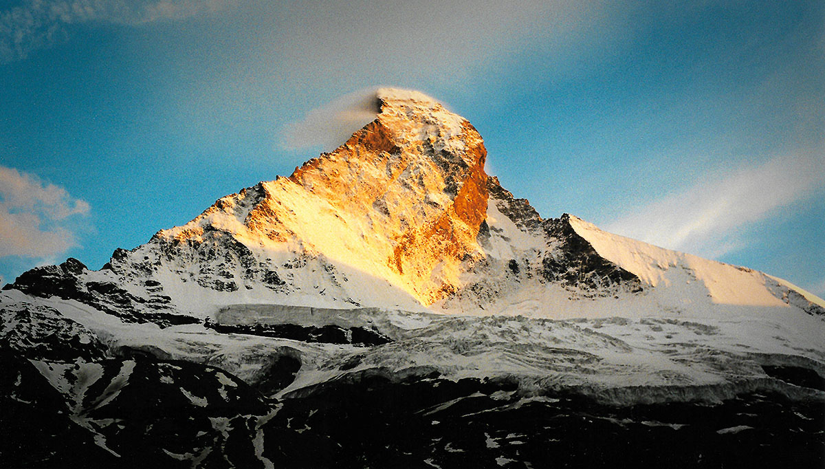
Leaving Trift, the Höhbalmen trail crosses a small wooden bridge and climbs a grassy slope in a south then westerly direction. In about an hour, the trail levels off on a treeless mountain bench called Höhbalmen, the namesake of the trail. On a clear day, the Matterhorn bursts into view. Known as Matterhorn in German, Mont Cervin in French, and Monte Cervino in Italian, the pyramid-shaped mountain that graces so many touristic brochures throughout Switzerland ceaselessly inspires wonder and awe. Some people call the Matterhorn “the most photographed mountain in Switzerland.” The Matterhorn is just a brushstroke, however, on a much larger canvas of mountains. From a vantage point on the Höhbalmen, a hiker can see an imposing wall of 4,000 meter peaks, and the Matterhorn is just one peak out of many.
Beginning with the Matterhorn and working to the left, a hiker with a keen eye can spot the Breithorn (13,661 feet/4,164 meters), Pollux (13,425 feet/4,092 meters), Castor (13,871 feet/4,228 meters), Lyskamm (14,852 feet/4,527 meters), and the Monte Rosa massif (15,203 feet/4,634 meters), just to name a few. The Monte Rosa massif is a collection of 10 main summits (including the Dufourspize mentioned earlier) and is the second highest mountain in the Alps after Mont Blanc. If you continue looking left from the Monte Rosa then you can see the Weissgrat (literally, the “white ridge), with it’s Gornergletscher (Gorner Glacier) descending like a giant tongue of ice. You can also spy the Rimpfischhorn (13,776 feet/4,199 meters), Allalinhorn (13,212 feet/4,027 meters), Alphubel (13,799 feet/4,206 meters), Täschhorn (14,734 feet/4,491 meters) and the Dom (14,911 feet/4,545 meters). This last mountain, the Dom, is an interesting character. While it’s true that the Dufourspitze is the highest summit in Switzerland, it shares a border with Italy so it’s not entirely in Switzerland. The Dom, by contrast, is the highest peak completely residing within Swiss territory.
As if the Swiss mountain views weren’t enough, the Höhbalmen viewpoint is typically filled with all types of wildflowers including the famous Edelweiss. The local tourism bureau advertises the Höhbalmen trail as the “Edelweissweg” (the Edelweiss path) and they’re right to do so. If alpine wildflowers are your thing, then the Höhbalmen is for you. Continuing along the Höhbalmen, the views just get better and better. Straight ahead you can see the Tiefmattengletscher and Stockjigletscher (two sparkling glaciers) spilling down at the end of the valley.